

Cataloged as the strongest earthquake in 100 years by the president of Mexico Enrique Pena Nieto, the southwest coast of this Latin American nation is shaken leaving human losses and immeasurable damages in the infrastructure.
The quake of an 8.1 magnitude shook Mexico at midnight Thursday to Friday, leaving at least 16 confirmed deaths: 10 in the Isthmus zone of Tehuantepec, in Oaxaca, four in Chiapas and two in Tabasco, according to the Civil Protection coordinator, in an interview with Foro TV, a CNN affiliate.
According to the report of the National Seismological Service, the tremor was the result of contact between the Cocos Plate and the North American Plate. President Peña Nieto said that 50 million Mexicans felt the earthquake and that 1.85 million homes lost electricity.
Según la última actualización, el #sismo tuvo una magnitud de 8.2 grados, es el más intenso en casi un siglo
— Enrique Peña Nieto (@EPN) September 8, 2017
Me dirijo al Centro Nacional de Prevención de Desastres para una evaluación general de los efectos del #sismo en el territorio nacional
— Enrique Peña Nieto (@EPN) September 8, 2017
The earthquake was 69 km deep and the epicenter was located 113 km south of Tonalá and 198 km south-southwest of Tuxtla Gutierrez, not only was felt in Mexico, but Guatemala City and other areas of Central America also felt the strong shaking.
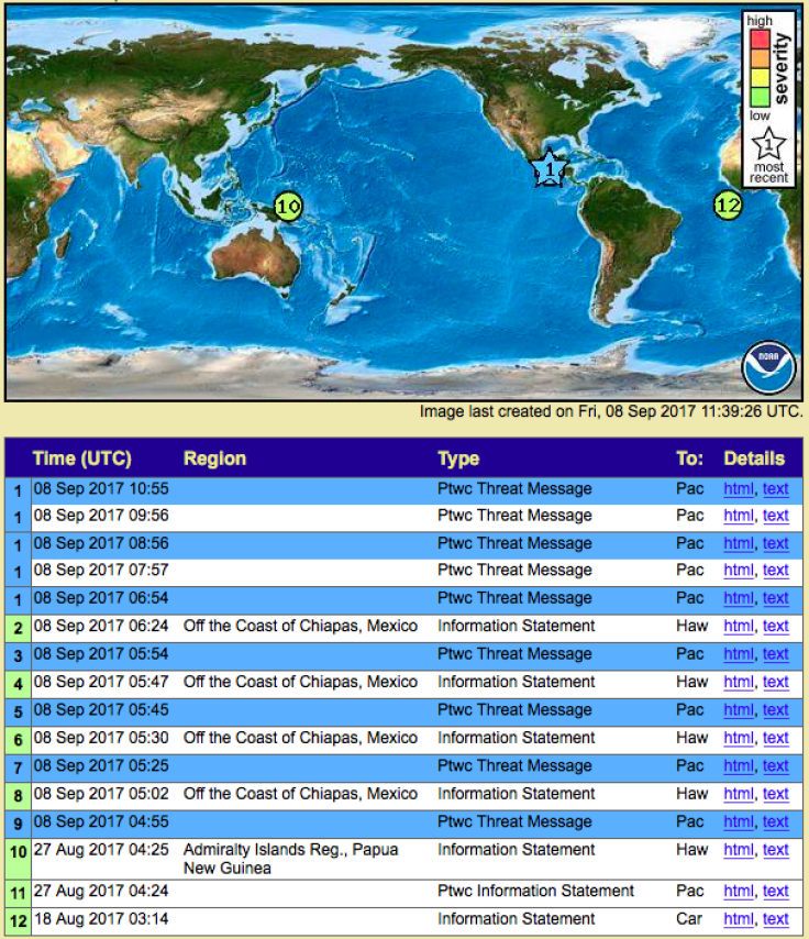
Mexican authorities have reported wreckage in Chiapas following the quake, while the Pacific Tsunami Center has confirmed a tsunami in Mexico, with waves as high as 0.7 meters. The possibility of huge waves of tsunami after the earthquake is still in force, so there are threats to all coastal countries that are close to the area.
The center said that waves of almost one meter could be registered in Ecuador, El Salvador and Guatemala, as well as in New Zealand, American Samoa, Cook Islands, Fiji, French Polynesia, Kiribati, Tokeau, Tuvalu, Vanuatu and Wallis Fortuna.
The epicenter of the earthquake was located between Oaxaca and Chiapas, being in these states where they registered important affectations. As it is the case of Juchitán in Oaxaca where there were at least four people dead, according to local authorities, and that the municipal palace was collapsed to 50%, as well as a collapsed hotel in the town of Matías Romero.
The National Civil Protection Coordination in Chiapas issued the declaration of emergency for the 122 municipalities of the Mexican entity, carrying out a preventive evacuation of the locality of Puerto Madero by tsunami alert.
Emite Coordinación Nacional de #ProteccionCivil declaratoria de emergencia para los 122 municipios de #Chiapas tras el #sismo magnitud 8.4 pic.twitter.com/kKtaSxc5Ad
— Manuel Velasco (@VelascoM_) September 8, 2017
Mexico is located in an area of high seismicity due to the interaction of 5 tectonic plates: North America, Cocos, Pacific, Rivera and Caribbean plates. For this reason the occurrence of earthquakes is not rare. The SSN reports on average the occurrence of 15 earthquakes per day of magnitude.
In the 20th century, there were 3 large surface earthquakes with magnitudes greater than 7 degrees on the coast of Chiapas and Guatemala. The first occurred near the Mexico-Guatemala border, on April 19, 1902 (M 7.5); the second on September 23, 1902 (M 7.7) on the north coast of Chiapas and the third on January 14, 1903 (M 7.6) on the south coast of Chiapas.
When an earthquake of considerable magnitude occurs the rocks that are near the zone of rupture undergo a rearrangement, which generates a series of earthquakes in the zone that receive the name of replicas. The number of replicates can range from a few to hundreds of events in the next few days or weeks of the major earthquake. To date, more than 60 replicates have been reported.
Hasta la 01:50:00 se han registrado 61 réplicas (La mayor magnitud 6.1) de sismo ocurrido en cercanías de Tonalá, Chiapas (M8.4)
— Sismológico Nacional (@SSNMexico) September 8, 2017
NOTE: The information contained in this report should not be considered final. The National Seismic Service continues to receive new seismic data and with them, adjusting, renewing and improving the accuracy of seismic event parameters.
© 2024 Latin Times. All rights reserved. Do not reproduce without permission.