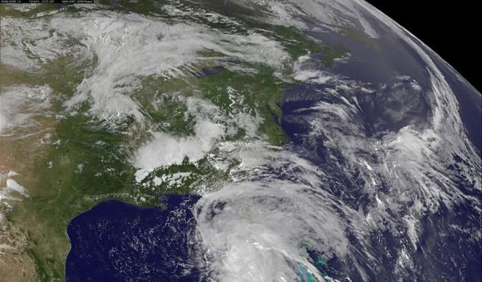
As Tropical Storm Dorian continues to push across Atlantic waters, those living along the East Coast of the United States are wondering how the fourth named storm of the 2013 Atlantic Hurricane season will impact their lands.
According to Weather.com, Tropical Storm Dorian will continue to move west-northwest over the next slate of days along the south side of the Bermuda-Azores high while remaining on open waters for most of the approaching weekend.
Expected to approach Puerto Rico and the Virgin Islands Sunday night into Monday and the Dominican Republic and Haiti on Tuesday, the storm is not expected to reach Hurricane-force winds of 74 miles per hour and above.
With the storm taking shape over Atlantic waters there is obvious attention coming from residents of the U.S. Eastern Coast.
The NOAA issued a weather statement regarding the path of Tropical Storm Dorian early Friday morning and even though the storm seemed to weaken late Thursday night, the speed of the storm continues to pick up, moving in the aforementioned west-northwest direction at a speed of 20 miles per hour with sustained winds of 50 mph.
RELATED: LeBron James Team USA Career Over? Miami Heat Star Will Not Play For USA Basketball In 2014
NOAA's storm tracker and computer spaghetti models are in general agreement that the projected path of Tropical Storm Dorian will change more to the west today due to a deep-layer ridge over the central and eastern Atlantic that is steering the storm.
The cyclone is expected to move over much warmer seawater which increases the chances that Tropical Storm Dorian grows stronger during the next 48 hours.
Spaghetti models disagree however, on Dorian's speed over the next few days. Increased or decreased strength of the storm depends on how quickly Dorian moves to the west.
The slower Dorian moves, the better chance the tropical storm has of growing stronger over the next few days.
Despite the weakening of the Tropical Storm Thursday evening, multiple reports indicate that it is still too soon to predict whether or not the state of Florida will be affected. The Orlando Sentinel says that if they storm were to aim straight for the southern state, their could be landfall by Wednesday or Thursday of next week.
While speculation continues and meteorologists continue to track the storm, people should be know that each storm is unique in its own right and Eric Berger of the Houston Chronicle wants everyone to be aware of multiple scenarios that could pan out in the coming days.
Although Dorian is moving over slightly warmer water than yesterday, for now conditions do not appear optimal for intensification. It is not a certainty the storm will survive the next couple of days, with dry and and wind shear intruding into its circulation.
In fact the European model, which hasn't handled the storm well so far, dissipates the system over the next five days.
However, if Dorian remains a reasonably strong system in about five days time, and does not slam into Hispaniola or Cuba, wind shear and sea surface temperatures should favor some intensification as it approaches the Bahamas.
If the system reaches point it would not surprise me if Dorian became a hurricane, and possibly a strong one.
WATCH REPORT On Path Of Tropical Storm Dorian


© 2025 Latin Times. All rights reserved. Do not reproduce without permission.


